AT Day Nine: A Summit in Question

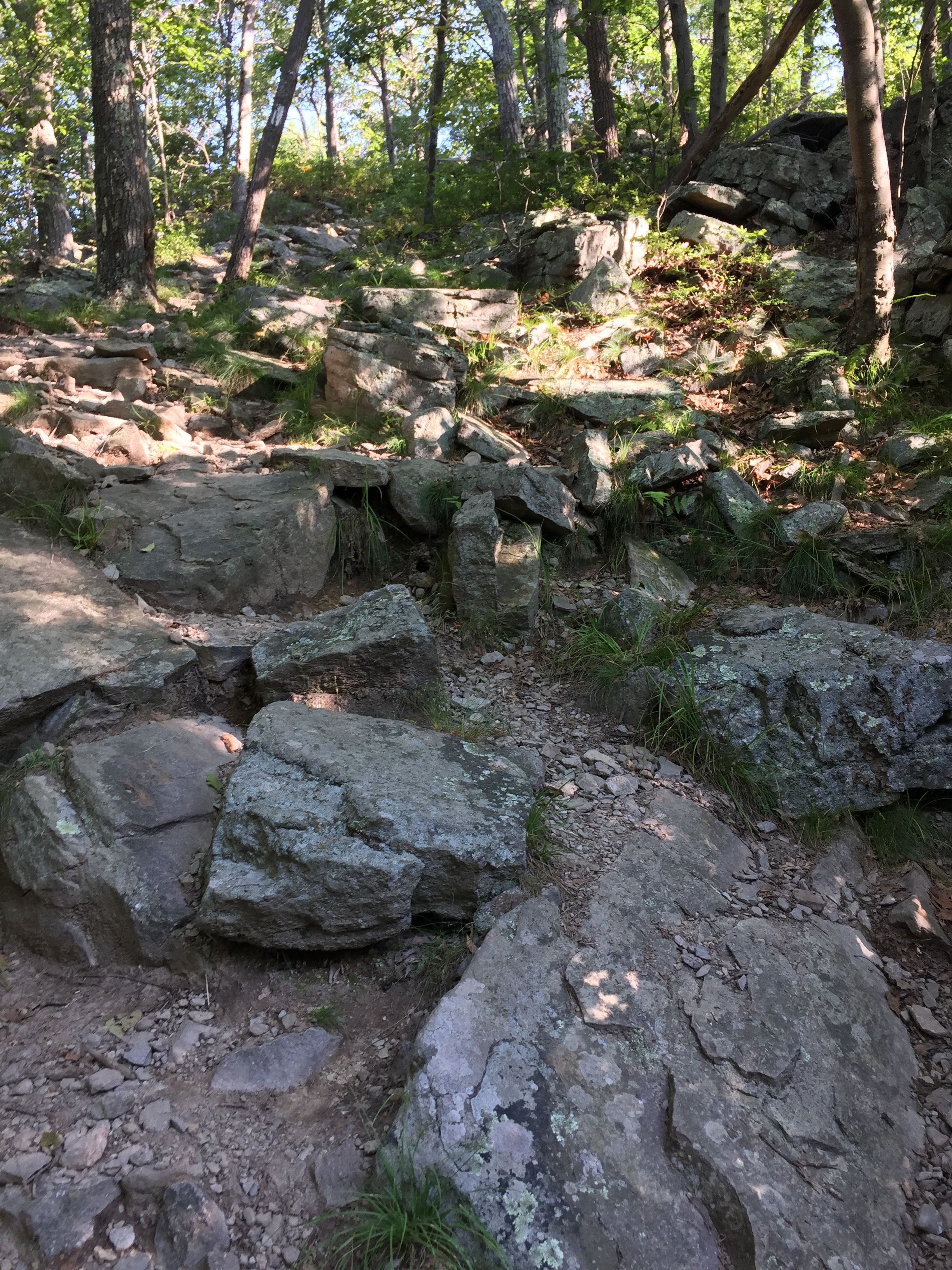
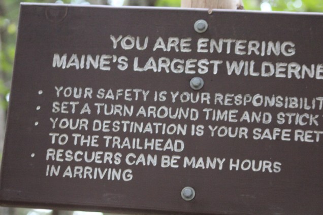
Depending on whom you talk to, the hike up to the top of Mt. Katahdin is in the top two or three of the AT’s most challenging hikes. At over 10 miles, over 4,000 feet up (and then down), and an estimated 10 hours in length, it brings to bear challenges with time (will I finish before dark?), food (will I starve on the mountain?), water (will I die of thirst on the mountain?), and weather (can I pack enough clothes?). This last one is a biggie, as the temperature can vary over 40 degrees on the hike, and while it may be sunny and warm at the base of the mountain, it can be near-freezing, with gale-force winds, zero visibility, and rain at the summit.  It’s also not so much a hike, as it is a CLIMB over rocks and boulders of all sizes.

Oh, I should probably mention something I’ve left out to this point:  In addition to fulfilling a promise to Lisa to complete the hikes in the remaining seven states of the AT, I had planned — and up to this point accomplished — distributing some of her ashes on each of the hikes (usually at the summit or some other beautiful spot on the hike). I had only one more hike to go, and the summit seemed the perfectly ultimate place to complete this part of my commitment. For months I had my heart set on this hike.

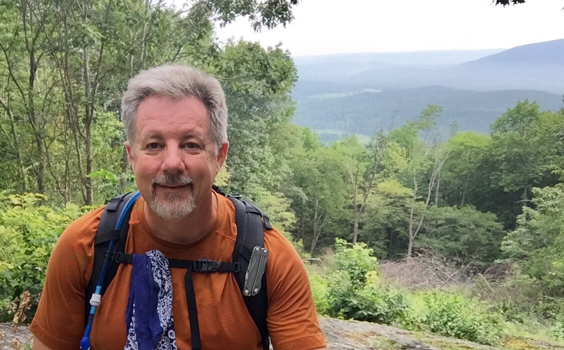
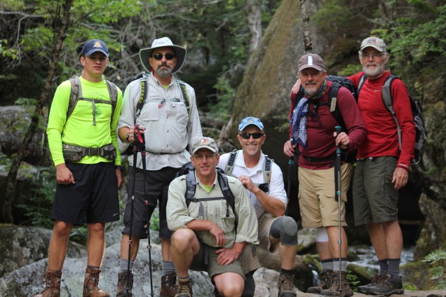
With this as a backdrop, our planned departure for our four-hour drive towards the mountain sat squarely in front of us. I say “us” because in addition to myself, five intrepid guys had heard of my mission and wanted to join me. Ernie offered to join me early on as I was beginning to plan my hikes (I had hoped Ernie would, so his offer was music to my ears).  A couple month’s later, Ernie’s brother Don, and Don’s son Dana asked if they could join us (Answer: Of course!). A couple months after that, Steve and Bob —long-time friends of Don and  Ernie — also inquired about joining us (Answer: Of course!).  Oh, and I should mention that Don was a paramedic in the Army in a past life, and Steve (a professor of Fire Science) had a career as a fireman and EMT. With this committed band of hikers the question as to whether the hike would happen was moot; it was now just a matter of how much of the hike would I do with them, given my ever-worsening condition?

On the early morning of our planned assault, I told the group I was going to do the prudent thing, and just hike a mile or so, and then hike back. I figured I could accomplish that without too much pain or further damage to myself.  They were all very encouraging and agreed that was probably the best plan.

4

And then we started hiking.

6
The best hiking team a person could want (L-R: Dana, Ernie, Don, Steve, Brian, and Bob).

5

I was being careful to really favor my injured leg by forcing my good, left leg to do most of the heavy lifting. I also had trekking poles, and that helped as well. After the first mile, I was feeling pretty good, and although a little skittish about the thought of having to make the painful hike down, I pressed on.

At the second mile, the hike begins to get pretty steep, and is more rock climbing than hiking. Going up with the help of my hands probably made it a bit easier on my leg, although I didn’t want to even think about having to do this steep climb in reverse.

The third mile was more of the same steep rock climbing, although we were now into the clouds and the weather got cold, windy, and misty.  More clothing was put on, and I seemed to be on a roll, with the encouragement of my great hiking team.

After the third mile was the promise of the “Tablelands,” where the terrain levels out to an almost rock-strewn pasture for about a mile. This was the easiest part of the hike, and I continued to make good progress walking through the increasingly windy clouds.

19

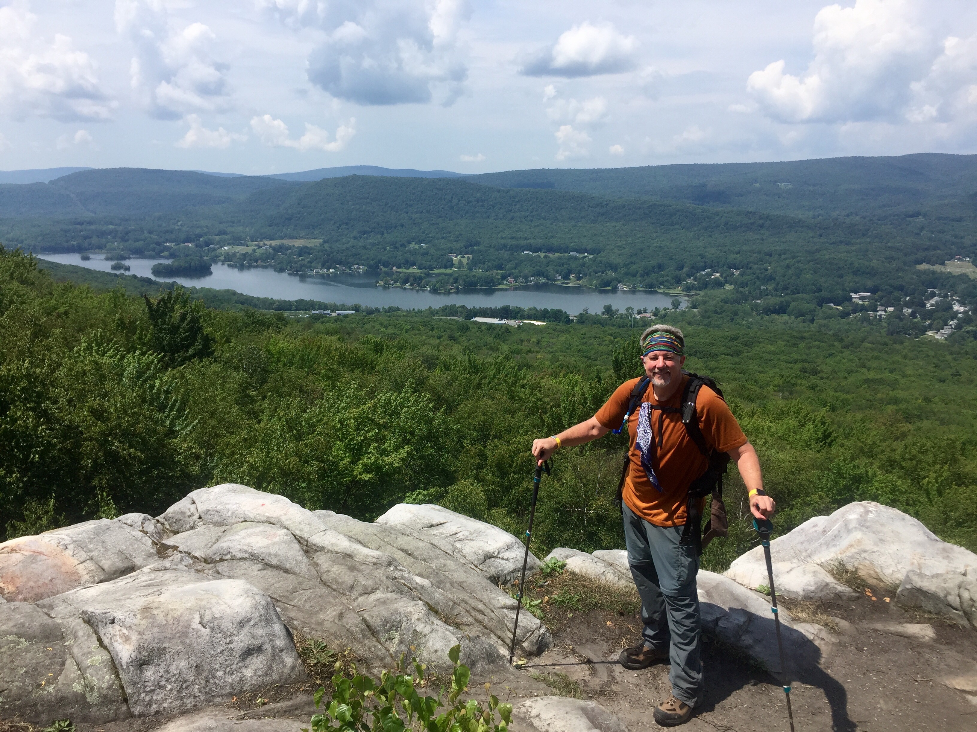
The last mile, while a return to the steep rock climbing of previous miles, provided the promise of seeing the summit. At this point it was becoming clear that I was indeed going to make it to the top!  Although the thought of needing a helicopter rescue from the summit seemed like a very real possibility.

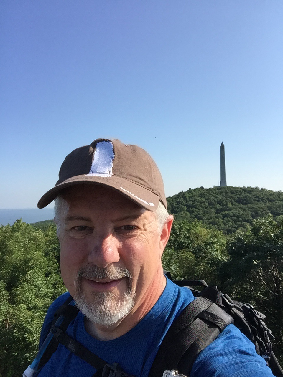
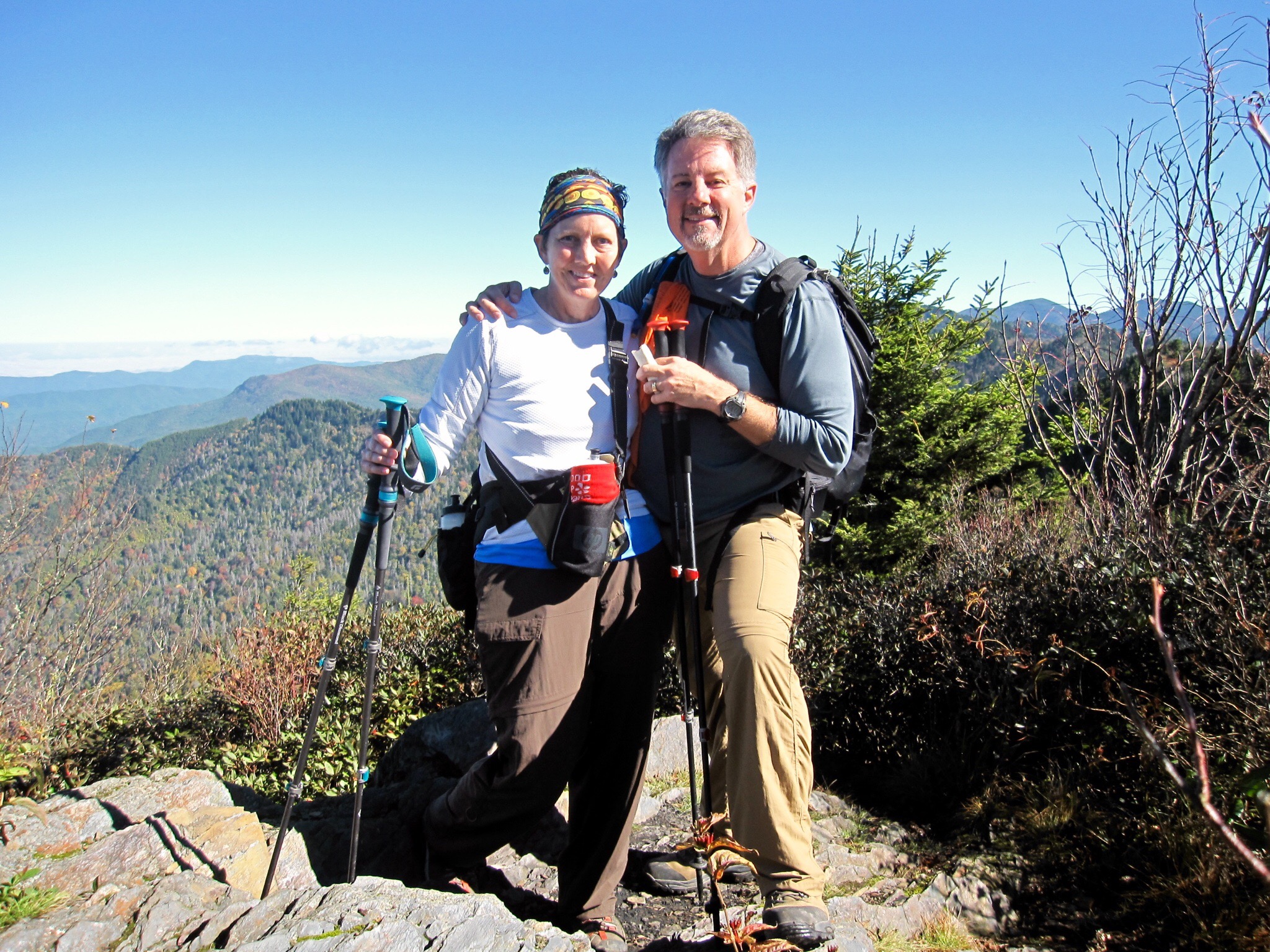
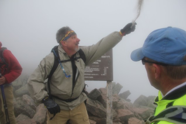
On this particular day, you didn’t see the summit until you were within a few feet of reaching it. The wind was now howling in excess of 40 miles per hour, and the visibility was maybe 40 yards max, so when we saw the AT’s famous northern terminus sign, we could almost reach out and touch it.  Our team, like many teams of AT hikers before us, had an intimate celebration at the top with the requisite photos near the famous Katahdin sign.

15

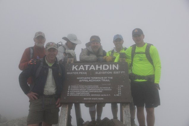
It was 22 months to the day since Lisa and I started the southern leg of our AT “challenge,” and so it was then that I commenced with the most important part of the hike — the part that motivated us all to do the hike in the first place — and that was scattering Lisa’s ashes. Interestingly, when Lisa and I stood on the southern terminus on Georgia’s Springer Mountain, it was cold, gray, and wet.

1
Lisa’s and my hiking boots at the southern terminus on Springer Mountain, GA.

On this day, it was again cold, gray, and wet, and thanks to the gale-force winds, Lisa’s presence was quickly felt over a large part of Maine’s most famous mountain. Another tearful “hug-fest” among six grown men took place, and we all commented that it was one the most memorable events of our collective lives that we were sharing.

1 (1)

Flora and Fauna Update
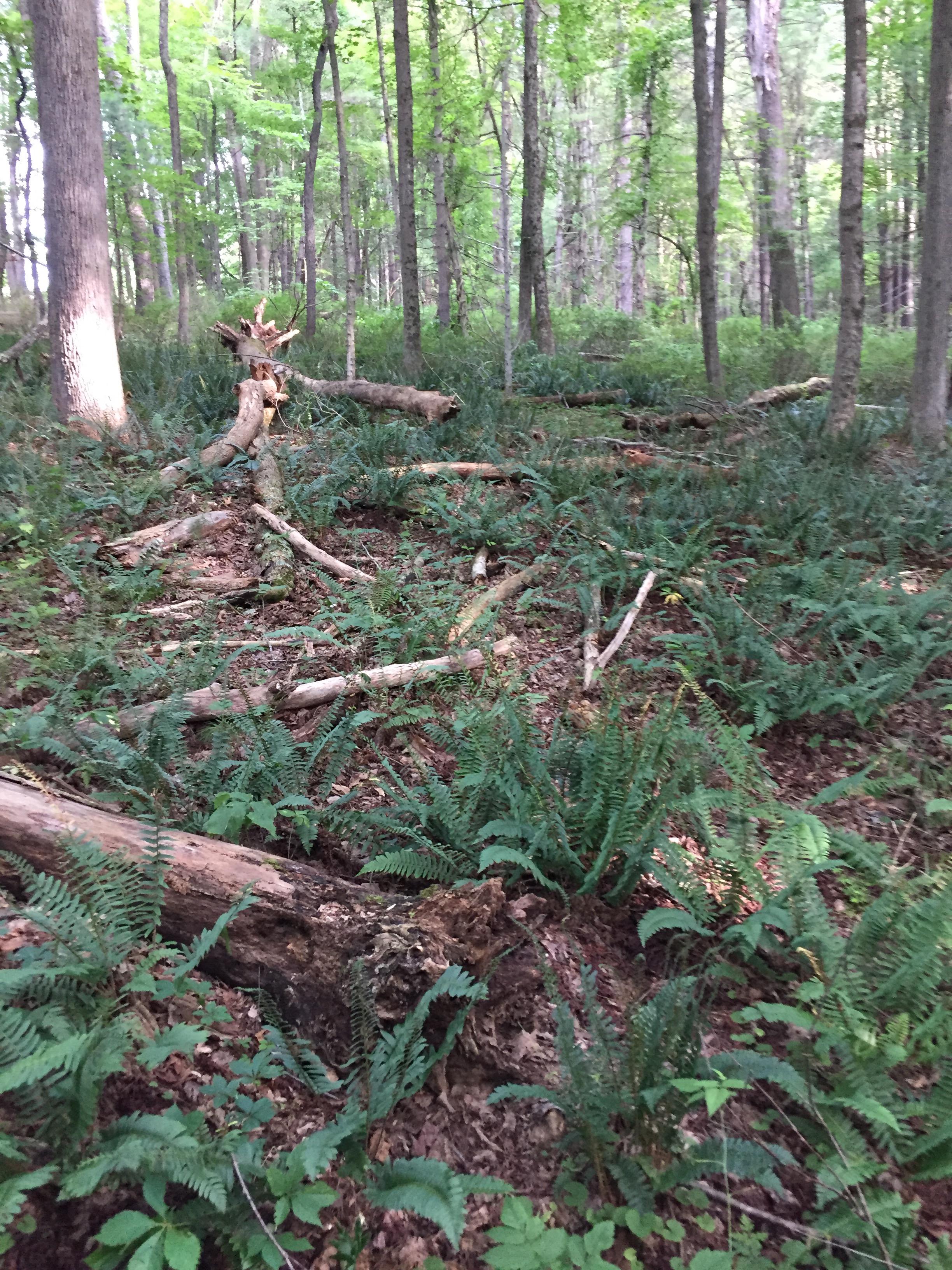
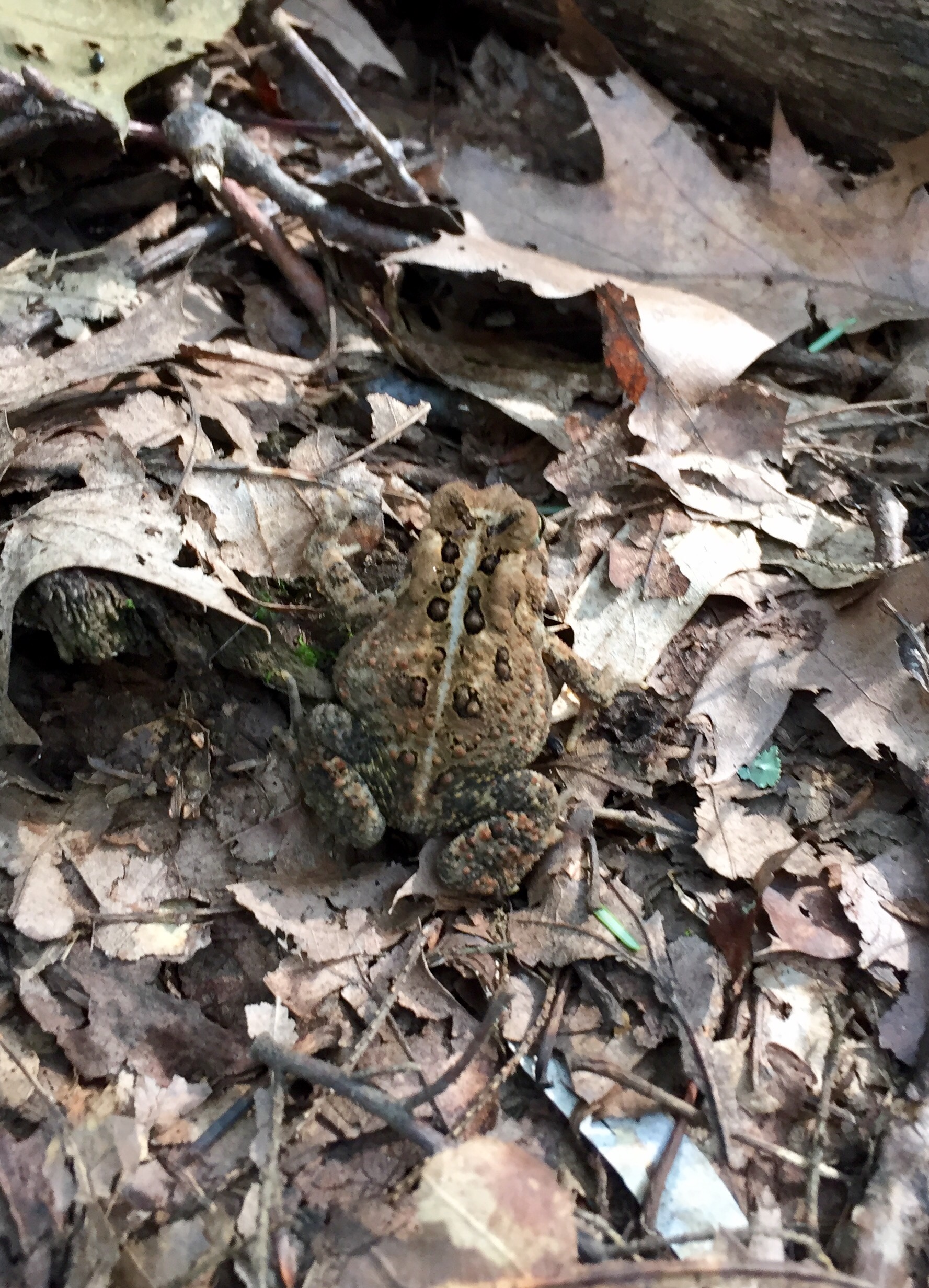
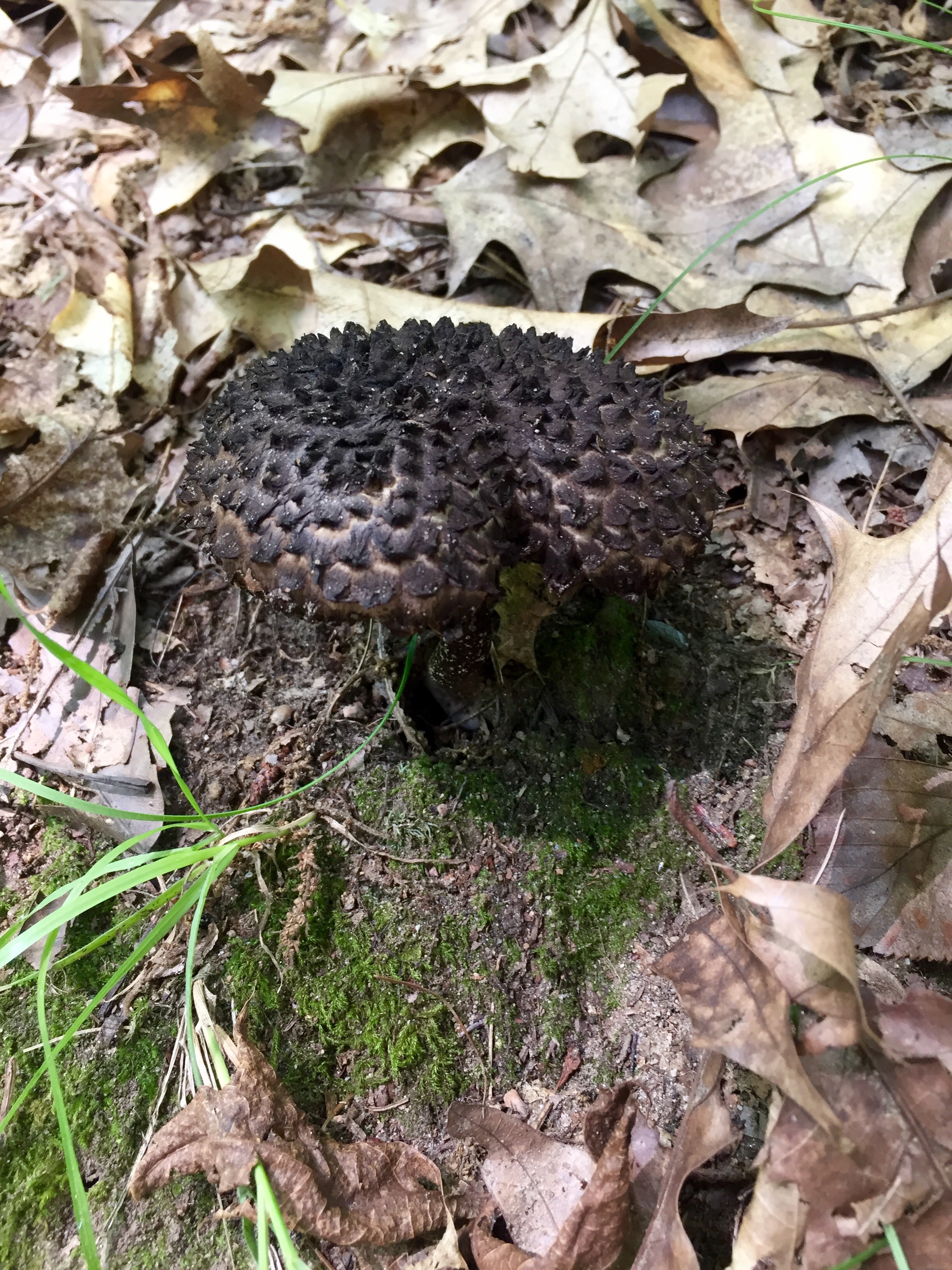
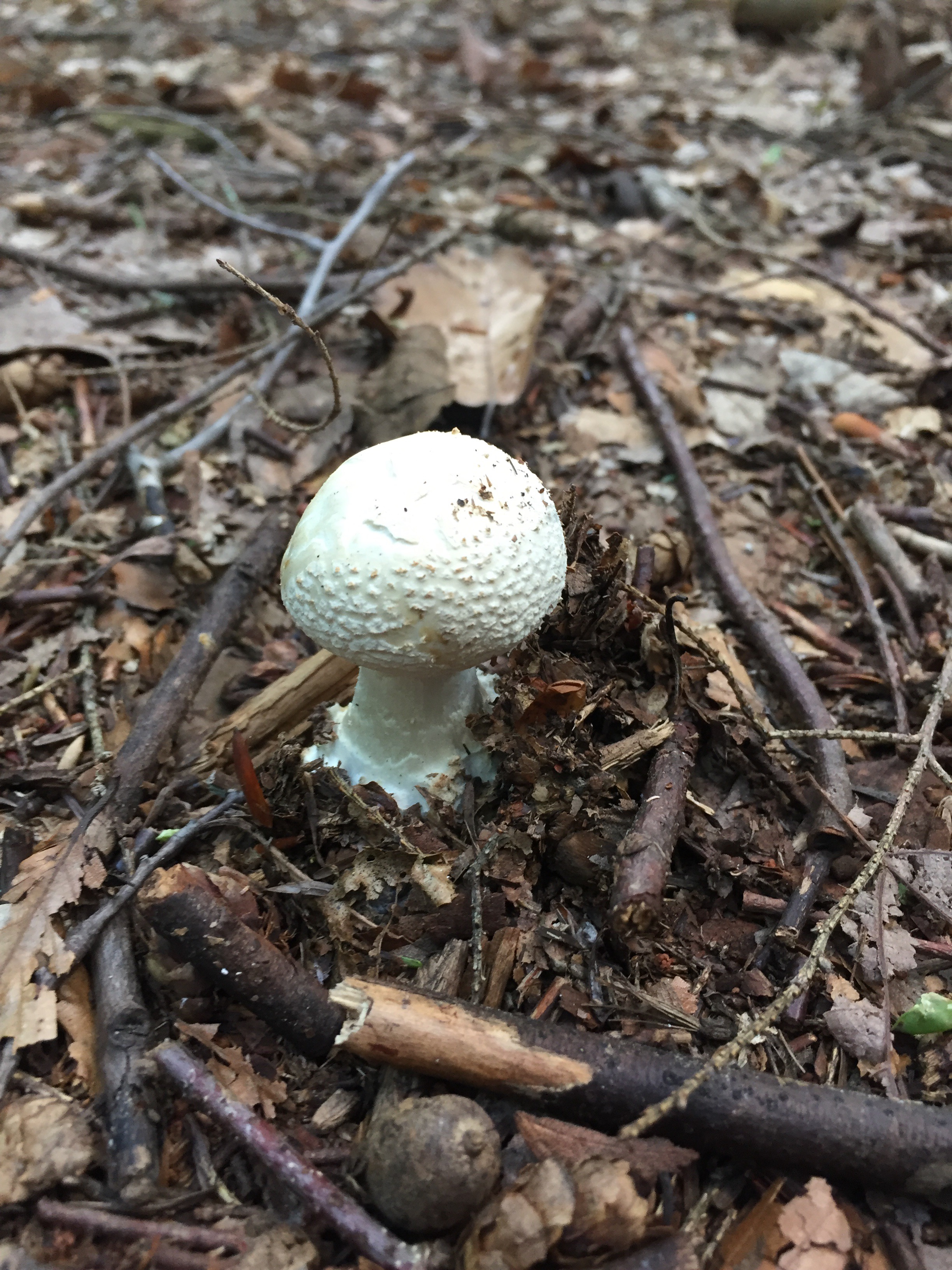
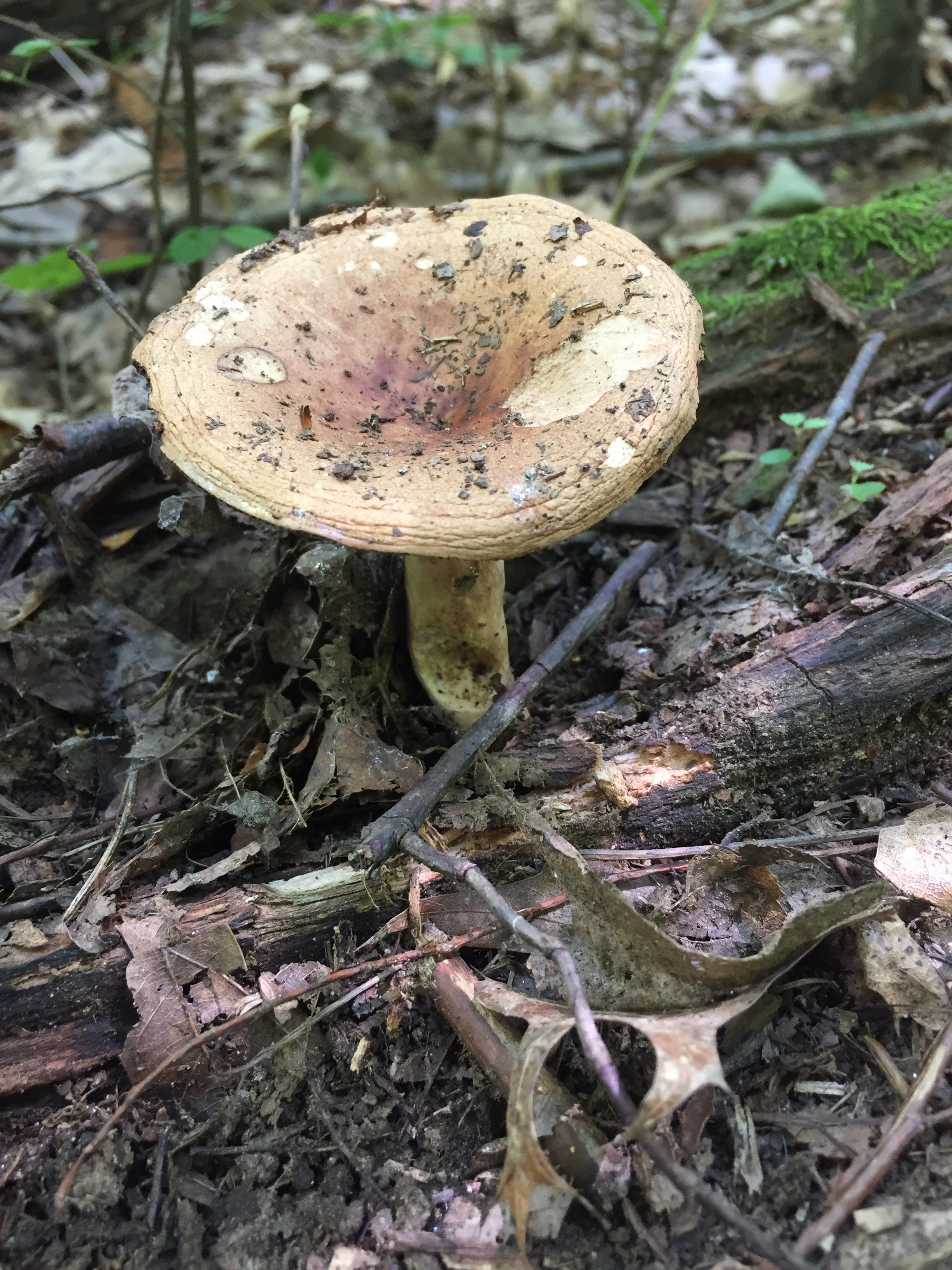
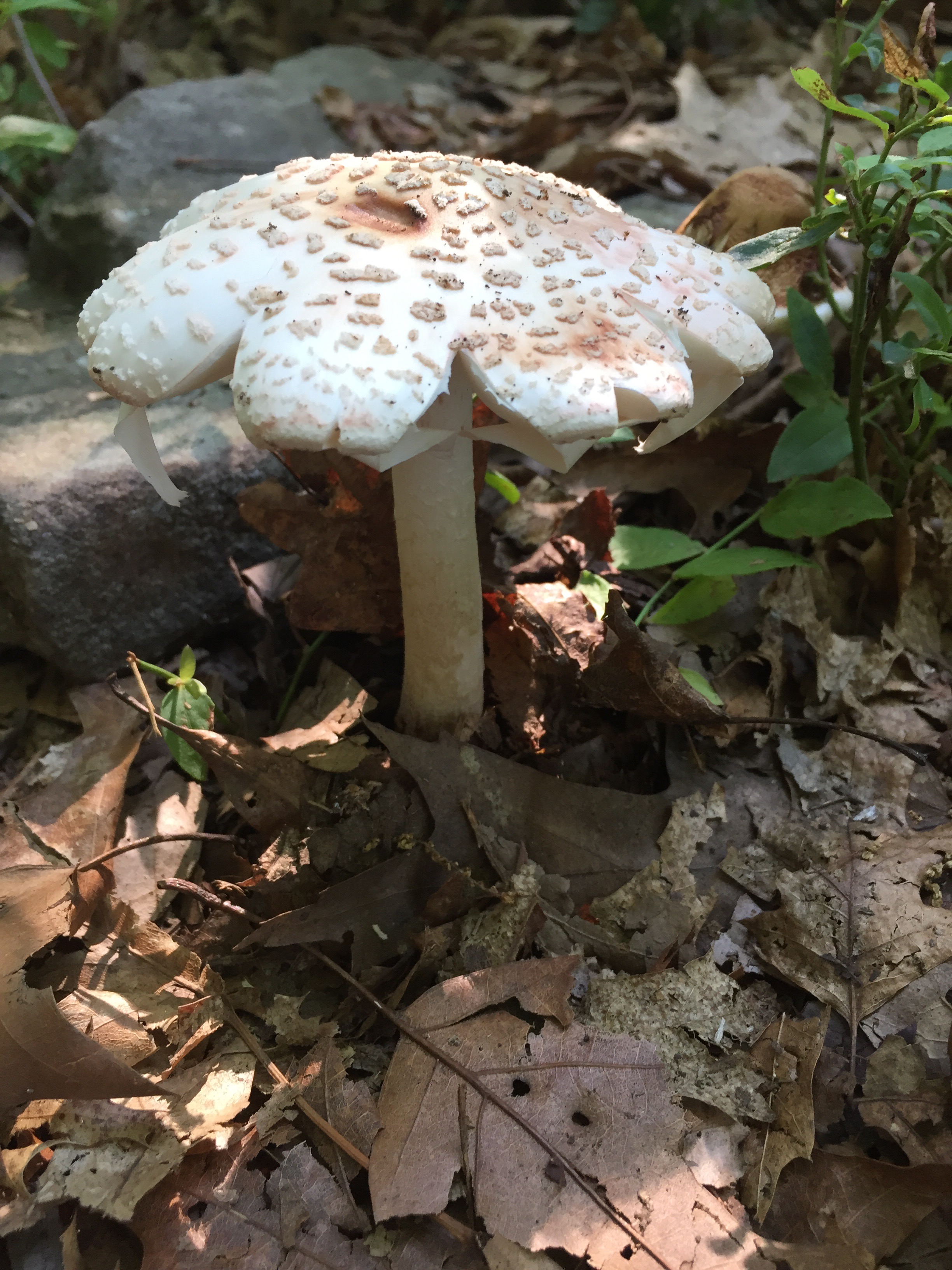
Aside from wild blueberries and one interesting mushroom, there was very little on the flora front that caught my eye. However, on the fauna front, it was much more profound. As some of you might know, Lisa and I were bird people. We even discussed that if we were to share any messages between us in the future, that we’d do it through unusual bird sitings. That said, as soon as I spread Lisa’s ashes, our group was joined by a raven at the summit.   They are an uncommon and very large crow-like bird of extreme northern climates. Our raven hovered, soared, and dove over us in the high winds as if to acknowledge our achievement, but maybe also to scold some of us (read: me!) for climbing to the summit.

Getting Down the Mountain: An Anticlimax of Adventurous Proportions
Of course the gravity of the situation quickly set in, and the pressing question was how to best get down the mountain.  For better or worse, half the team went down the way we came up, and the rest of us took what we thought might be a less steep, albeit longer route down the other side of the mountain. We decided the first group would get to the trucks and then drive to meet us. Things don’t always go as planned, however.

16

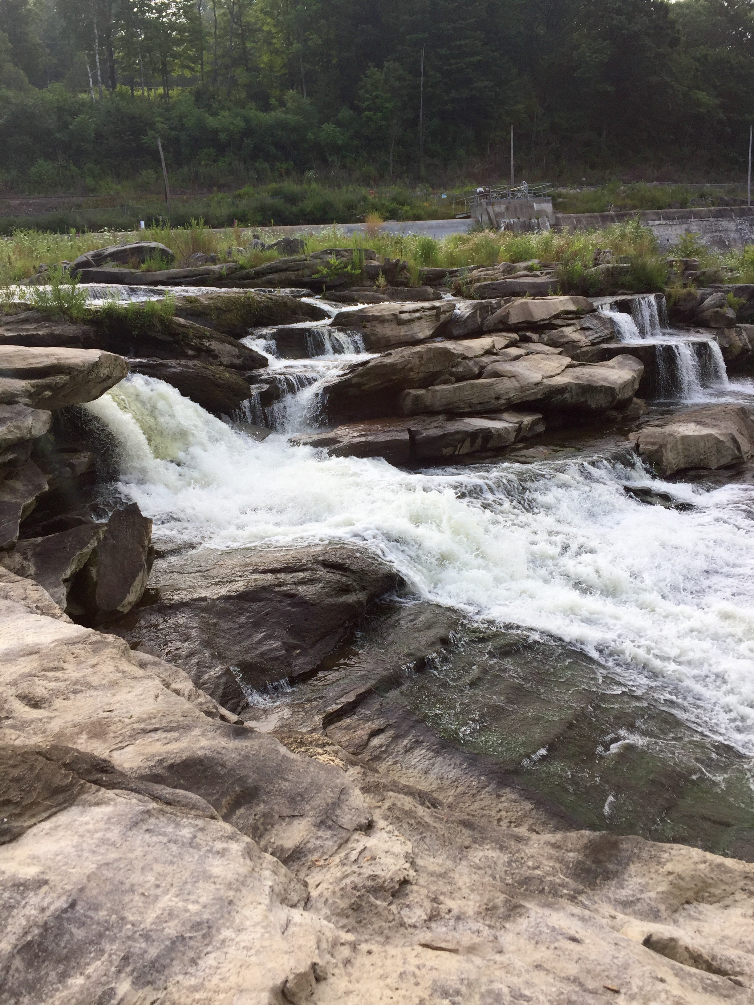
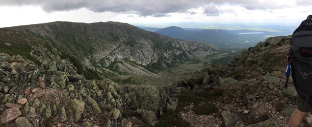
In order to make a long, somewhat anticlimactic, story shorter, just let me say that the our return route down the mountain ended up being four miles further than our trip up, and it wasn’t an easy four miles. In fact, we actually descended almost 1000 feet only to climb almost another 1000 feet to another sub-peak of the mountain (Hamlin Peak) before heading down the fairly steep Hamlin Ridge line.  On the plus side, our new route provided some beautiful vistas of the back side of the mountain range.

5 (1)

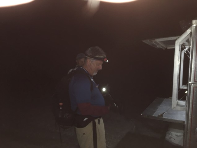
We ended up hiking until almost 11pm into the evening, using headlamps to help us down the rolling and rocky trail for the final three hours. In the end, my three-person team hiked almost 14 miles and over 14 hours, and thankfully, my whole body seemed somewhat numb on the return hike to reunite with the rest of our team.

3

How quickly the numbness fades.  It quickly became evident that the “no pain, no gain” axiom was alive and sadistically well when it came to this final hike of Lisa’s and my “14 State Challenge.” I will save the gory details of post-hike pain for perhaps a later epilogue post, but as I write these words one week hence from that eventful day, I will just say that I’m still paying a fairly steep “pain tax” for my decision to hike to the summit of Mount Katahdin. I would also add that I wouldn’t have it any other way.

AT Days Five Thru Eight: An Assault on Hold?

By design, I had planned to put a few days of rest between the first six hikes and the final major summit to the top of Maine’s mile-high Mount Katahdin (the Appalachian Trail’s northern terminus). The plan included heading to Maine to stay with my good friends — and Maine natives — Ernie and Christine Nichols, who live in Tennessee during the school year, but have the great foresight and wisdom to escape the heat and humidity of the South by moving to their “camp” (that’s Maine-speak for lake house) on Sebago Lake for the summers. It’s a beautiful place, on a beautiful lake, with a not-so-bad view (that last bit is what is known as New England understatement). They’re wonderful hosts, and my stay included great dinners with family and friends, a day-tour of Christine’s hometown of Portland, and relaxing lake time.

The ensuing three days also saw my leg injury first get a little better, but then get steadily worse, to the point where walking and sleeping was a challenge. We all pondered whether it made sense to do the hike, or perhaps put it off for next summer (you know, “live to fight another day” and all that…um, stuff). I went in for an x-ray, which confirmed Sarah’s and Christie’s earlier diagnosis (way to go ladies!). The doctor in Maine prescribed heat, elevation, mucho ibuprofen, and no strenuous activity.

I didn’t tell the doctor about my dilemma with Mount Katahdin, which was now weighing very heavily on my mind.

AT Day Four: The Painful Search for New Hampshire’s Ethan Pond

There had to be drama. Things were going too well.

For the first time this week, I was going to have a hiking partner, and what a good one it was. I’ve known Glenn for over 30 years — since my earliest days at IBM — and we’ve managed to keep in touch across the miles and over the years.

IMG_8020

On the flora and fauna front, we saw a big black bear cross the street in front of us while driving to the trailhead. Seeing a bear from inside a car is exactly the way I like to see them! It was moving so fast, I wasn’t able to get a picture <sorry!>. This was dramatic, but not the drama I’m talking about.

Once we got close to the trailhead, we couldn’t quite get to the parking area, as a good-sized tree had blown across the road during an overnight storm. In the process of trying to drag it out of the way, the upper trunk of the tree snapped, quickly striking me across the upper thigh. Now, I’ve had “Charlie horses” before, but this one had me seeing stars. Once the stars cleared, and I regained my composure, I was faced with a decision: start the 6-mile hike up the mountain, or abort the mission. My “logic” at the time told me that perhaps hiking would help my newly-cramped-up thigh — you know, loosen the muscles and all that. So up the hill Glenn and I proceeded in search of Ethan Pond.

Without getting into all the gory details, let me just say there was a lot of leg swelling, very slow one-legged hiking, some very pretty trails (and mushrooms!), and a beautiful mountain-top lake known as Ethan Pond. The guidebooks say that the trail here is full of bears and moose, and most people in northern New England know that the moose is the one to worry about. So we kept our eyes peeled, but alas no big furry animals graced us with their presence.

Once we were safely back at Glenn and Amy’s cabin on Pine Lake Pond (they call them ponds in the northeast; we in the South or the Midwest would call them stunningly beautiful lakes), Glenn and Amy’s daughter Sarah (a newly-minted Physician’s Assistant) and their cousin Christie (a veteran Physical Therapist) diagnosed my injury as a deep thigh muscle bruise. They prescribed ice, elevation, mucho ibuprofen, and rest.

All in all, what should have been a strenuous three-hour hike ended up being an almost eight-hour exercise in torture, given my hobbling down the mountain (hiking downhill is always the hardest, but now it was painful too). Glenn was a great hiking partner, patiently waiting for his injured friend each small step of the way, and I’ll never forget him or this hike. I fell asleep to the sound of the resident loons, wondering if my hiking adventure had come to an abrupt and unfortunate end.

AT Day Three: The White Cliffs of…Vermont

You know you’re first one on the AT in the morning when you come face-to-web with the overnight handiwork of all the spiders in the area that for some reason feel the need to bungee jump from one side of the trail to the other. Spider webs aside, today was the first day where there was only one hike on the agenda, and it was a good one.

Did I say good? What I meant was good and hard! I was hiking to the White Rocks Cliffs, and this was the first of my hikes that the AT Council rates as “strenuous.” What I learned was that my tough little hike the day before was merely a palate cleanser for today’s hiking entree. As soon as I crossed a little footbridge over a pretty stream, it was up, up, and away!


I wasn’t a half-mile into my walk when, as my Millennial students would say, “shit got real.” What I mean by that, is that right smack-dab in the middle of the trail was a big welcome gift from a bear.

IMG_7956

It didn’t look too fresh, but rest assured, I made sure my bell was tuned up and ready to go. Oh, and for those of you wondering, yes, the bear poop was in the woods. So that answers that.

They call this hike the “white rocks cliffs” because as you get to the top of hike, the rocks are made of quartzite, and are very white and translucent. At one point, the sun shone through the canopy and upon hitting one of these white rocks, lit up the forest floor.

IMG_7962

As I approached the top of the hike, I stumbled upon a sight that was the most moving so far. In a quartz field of rocks, previous visitors had erected dozens of cairns — little Jenga-like rock towers — as evidence of them being there, as a memorial, or just as an outlet for their creativity.  It was at once eerie, impressive, and moving. Of course, being a cairn-builder from way back, I had to erect one in honor of my very best friend in life.

To get to the cliffs, I had to head off trail, and the biggest garter snake I have ever seen (and I’ve seen thousands of them) was waiting to welcome me to the cliffs. What she was doing up there (yes, it was a female) is beyond me, but apparently there are enough mice, etc. to keep her fat and happy. As usual, all the work to get to the top was rewarded with an amazing view of the area mountains and countryside of Vermont.

After a quick descent and a shower, I made my way to New Hampshire via an out-of-the-way side trip to Burlington (think a northeast version of Madison, Wisconsin), and then a stop at the headquarters of Ben & Jerry’s for a touristy little tour of their ice cream operations (a guy’s gotta do what a guy’s gotta do).

Driving in this part of the country can test one’s patience as there are very few roads that are east/west (there are plenty of north/south). Consequently, my east-bound drive to New Hampshire was slow-going, which gave me plenty of time to appreciate the beauty of the mountains,  road-side streams and rivers, and quaint little resort towns (I drove past the town and lake of “On Golden Pond” fame.).  After a few hours, I arrived in New Hampshire in time for an evening swim, a gin and tonic, and great dinner with my long-time friends Glenn and Amy Bloom.

Day Two: The City Hike and the Country Hike

On some AT hikes, you’re not very far from civilization. You can often hear traffic noise as roads and highways are not too far away. On other AT hikes, you feel like you’re in your own little world. Such was the case with my first hike today. 
The Connecticut Hike.  After driving several miles down a dirt road, I came to the trail crossing. It was near a dam and natural waterfall on the Housatonic River. It was really off the beaten path. To further drive the point home, as I got out of my car, a Bald Eagle flew over. It gave me a look that said, “You’re not quite in the middle of nowhere, but you can see it from here.” 


It was a really tranquil hike. Between the rhythm of my steps and my guardian good luck bell, it was quite meditative as I climbed up towards the top of of Mount Prospect. The only interruptions were an occasional thru-hiker, but they’re a friendly sort for the most part, although some of them do make you wonder what or whom they’re running from.

I came across a natural spring. These are somewhat common on the AT, and usually present themself as a pipe coming out of the side of a hill, with water trickling out. This water can be collected, and should be filtered or chemically treated before drinking. And just like a watering hole in an African wildlife documentary, you usually see signs of life — in the form of hikers — at most springs. I met and chatted with a young woman from Brooklyn doing a solo thru-hike. 


For those keeping score at home, this hike was a mix of rocks and roots, and as usual, it was only the roots that tried to trip me. Damn things! I was also mostly walking uphill to the top of the mountain, but occasionally there would be downward sections. This might sound like a good thing, but hikers realize that they’re just giving back hard-won altitude that they’ll have to eventually win back. In this way, it’s almost like the mountain is sparring with you.

Once at the top, the view, as usual, was worth the effort. A quick run-walk down, and I was back in my car heading to civilization and my Massachusetts hike.

The Massachusetts Hike.  I originally planned this hike to be short and easy, given that my earlier hike was a fairly good workout. The hike started in the quaint little town (not a hamlet, but close) of Cheshire. I started out at the town monument, which was an old, half-ton cheese press from the 1700’s (apparently Cheshire Cheese was quite the thing, back in the day). Even in towns, the trail is marked with blazes, and some people live in neighborhoods on the trail, so they get used to seeing a steady stream of smelly hikers walking past their homes (I may touch on the fragrance of thru-hikers in a later post, but just know that as a day-hiker, I’m the freshest guy on the trail!).


Somehow I miscalculated this hike. It was over a mile longer than I had planned on, and it was the steepest hike so far (no sparring with the hill, just a constant barrage of elevation). It made me glad that I’ve been training for hikes like this for the last several months. My training included loading up a backpack with 30 pounds of weight, and then spending time on Stair Master machines, maximally-inclined treadmills, and even the Memphis Bluffs. 

The goal of this hike was to reach “The Cobbles,” which is AT-speak for huge rock outcroppings at the top of the hill. Again, the effort resulted in a view that went on forever (thanks clear weather), and also showed the Cheshire Reservoir, the Berkshires, and Vermont and New York in the distance. A somewhat slower descent than the morning got me back to town, where I couldn’t wait to get out of my hiking boots.

Flora and Fauna Update.  In addition to the Bald Eagle (which was awesome), some of the new sightings included:

  • More species of birds
  • Dozens of chipmunks (not sure why)
  • A woodchuck, a.k.a. groundhog
  • A family of deer
  • A toad

The toad sighting got me to thinking. You see, I really like toads. Have my whole life. I also really like — as you may have noticed — mushrooms (not just to eat, but to find and photograph). Anyway, it struck me that toads and mushrooms (toadstools?) have a lot in common. They’re not really pretty, tend to be warty, sometimes toxic, and almost always under appreciated. It occurred to me that toads are the mushrooms of the fauna world, and that mushrooms are the toads of the flora world. They could almost be each other.


Did I mention that hikers have a lot of time to think random thoughts on the AT? 

More tomorrow, from Vermont…

AT 2017: Day One – A Tale of Two Hikes

One of the things I like about the northeast U.S. is how close the states are to each other. Case in point: I woke up in Pennsylvania today, hiked in New Jersey and then New York, and tonight I’ll sleep in a Days Inn in Massachusetts. Without driving more than 3 or 4 hours. Cool.

AT Basics
I suppose I should start with some AT basics. The entire AT is a fairly well-marked trail. “Fairly” is a subjective thing, and marked means that there are symbols along the way to let you know you’re on the right track, er, I mean trail. The marks that are used are called “blazes,” and they are white brush strokes on trees or rocks every once in a while. Here’s a picture of me with a typical blaze:

As you can see, I even have a blaze on my AT hiking hat. Makes me wonder if I could get hikers to follow me if I wore my hat backwards…ha!  I’ve learned that the people who paint these blazes along the trail appear to follow two basic rules:

Blaze Rule #1: If the trail is obvious, paint the blazes close together, to lull hikers into a blaze-induced hypnotic state; and

Blaze Rule #2: If the trail is hard to determine, space the blazes way out, to induce a low-grade anxiety attack in the hiker while they wonder if they’re on the right track, er, I mean trail.

Rules aside, the trail maintainers are a wonderful group of people, and the AT wouldn’t be what it is without their tireless, voluntary efforts.

Talk to an AT thru-hiker (someone who walks all 2181 miles of the AT), and you’ll hear another axiom: that there is A LOT of monotony on this long walk. Doing day-hikes — of the sort I’m doing — tend to be somewhat less monotonous. Such was the case today, where my two hikes were different in many ways.

One way AT hikes can be different is in what the trail is composed of. Now, I’m not an expert on these things, but based on my experience with the AT so far, there are typically two main types of trail surfaces: Rocks or roots. Neither make for smooth sailing, but variety is, as “they” say, the spice of life. “They” should also point out that spicy lives are good in moderation.

The New Jersey Hike
My hike in New Jersey was a rocky walk up to that state’s highest point. There’s a monument there, so they refer to this hike as the High Point Monument hike (I love descriptive names). After several miles of walking on big rock, one’s feet start to hurt a bit. On the plus side, you do get pretty good traction. Here’s a photo of today’s typical rocky path:

Photos don’t do elevation justice. In the photo above, the path is about as steep as your roof — with big rocks on it. Notice the path is hard to make out (and so of course, there aren’t too many blazes…remember the rules!).  Overall, it was a nice hike. As it was early in the morning, it wasn’t too hot. Since it was up high, there weren’t too many bugs, and the sun was out.

Now back to that monument. I don’t know about you, but when I hear that term in relation to a woodsy trail, I think about a small rock or plaque marking the location. In fact, I know that the monuments at the ends of the AT are small like this. Imagine my surprise when I got close to the top of the hill and saw this in the distance:

Turns out, this monument is 220-feet high, about half as high as the Washington Monument. Pretty impressive. Of course I had to hike over there:

After this, I drove to New York. Besides the proximity of the states, the other thing that struck me was how charming all of the small towns are. I mean really charming…make your teeth hurt charming. You know, fully renovated, huge Victorian and Gingerbread houses, with horse farms and field stone fences set on rolling hills. Oh, and they’re not cities. They’re called towns, and villages, and…wait for it…HAMLETS!

The New York Hike
Anyway, outside this one hamlet, was my next hike. It wasn’t a rocky trail, it was a long boardwalk through a swamp, followed by a root-laden trail up a hill to a highland meadow. Here’s some shots:


Don’t let the pretty blue sky and the green meadow fool you.  This hike was much more uncomfortable. Thanks to the time of day, it was really hot and humid (apparently I brought the weather with me).  And thanks to the swamp, there were approximately a bazillion mosquitos and black flies (good thing I brought my head net). And thanks to the bugs, I had to hike fast the whole way up and down just to keep them at bay.  No stopping at all. Oh and the roots. Less traction than rocks, and they seem to rise up and trip you, a lot.

One good thing about a brisk, sweaty walk-run up and down a big hill and through a swamp is that you can talk yourself into the idea that you’re running a caloric deficit. Thankfully, this particular hike is well-known for having a food truck not far from the trail. It’s not that I wanted that hot dog, I needed that hot dog, nay I deserved that hot dog!

Flora and Fauna So Far
First, for question I get all the time, no, I didn’t see any bears. I try to make a fair bit of noise walking along the trail, and I even have a small good-luck bell from Lisa to announce my presence to the bears. I’m pretty  sure it doesn’t sound like a dinner bell. Probably more important than bears, I didn’t see any ticks either (that I know of).  That said, here’s what I have seen:

  • A wide variety of birds
  • Rabbits
  • Squirrels
  • A tree frog
  • Fish (in the swamp)
  • A turtle (in the swamp)
  • A bazillion mosquitoes and black flies (because of the swamp)
  • Two garter snakes

In the flora department, I noticed a wide variety of forest-floor fungi. Here’s a sample:


So, to recap, two interesting and very different hikes. I’ve got two more scheduled for tomorrow. I’ll report back from Connecticut and Massachusetts.  Until then…

AT 2017: Day Zero – The Eve of the Northern Assault

About six months ago, I began planning a hiking trip…more of a mission actually…to complete a series of day-hikes on the Appalachian Trail (AT) that Lisa and started in 2015.

Back then, Lisa was courageously battling cancer, and her battle plan included grabbing life by the ba…um…horns and doing those things we long wanted to do.  We decided on day-hikes since we didn’t want to get too far from medical facilities, and since we had a penchant for daily, hot showers, happy hours, and nice breakfasts and dinners.  We decided to select a well-known and/or picturesque hike in each of the southern seven states that are traversed by the AT. We hiked places like Harper’s Ferry (West Virginia), the pony-infested Grayson Highlands (Virginia), Charlie’s Bunion (North Carolina), the southern terminus — that’s fancy talk for “end/beginning” — on Springer Mountain (Georgia), and other pretty places in Pennsylvania, Maryland, and Tennessee.

At the top of Charlie’s Bunion.

It was a wonderful way to spend a week, and we talked about doing the northern seven states at some point in the future.  We also learned that the AT Conservancy had devised a thing called the “14 State Challenge,” and that we were already half-way to achieving it. Sadly, it eventually became evident to us that we wouldn’t complete the challenge, but we committed to each other that I would. Ultimately, Lisa became my spiritual guide and motivator in putting the plan in place.

Fast-forward to today. I landed in Scranton, Pennsylvania (much prettier than the producers of “The Office” would have you believe), and will begin my seven northern day-hikes in New Jersey tomorrow. Hikes in New York, Connecticut, Massachusetts, Vermont, New Hampshire, and the grand-daddy of them all, the northern terminus — Mt. Katahdin in Maine — will quickly follow.

For a couple of the hikes, very dear friends will join me. For all of the hikes, my spiritual guide will keep me company.

Check back for updates in the coming days.